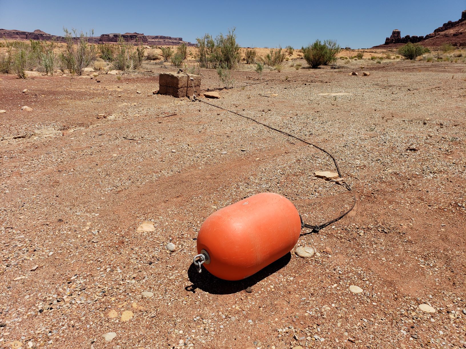
Hite Marina: See Any Boats?
What you see above is last year. It’s a picture of Lake Powell in 2022, during the worst drought we’ve ever had, year over year.
What you see below is this year, just a few days ago, as a matter of fact. It’s upriver from Lake Powell, along a different river, the lower Dolores, in mid-June.
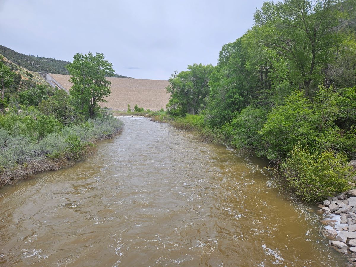
Lower Dolores, McPhee Dam in Background
What a difference a winter makes. Snowpack was way above average, in this part of the state, it was the highest percentagewise in all of Colorado. The water was nearly to the top of the dam. The spillway gleamed wet, though it didn’t overflow.
They’ve opened up the lower Dolores below McPhee Dam for the first time in years. I decided to drive across Bradfield Bridge to wander through a canyon verdant and buggy and quick with water. All the reservoirs upstream of Powell are at capacity.
Something about water and its copulation with desert. This canyon, complete with the ruins of Ancestral Puebloans and an old ranch, with side canyons that curl like thorns off the main trunk and its dirt road that ends about 11 miles from Bradfield Bridge, is one of America’s best kept semi-secrets.
The Dolores River Canyon begins somewhere south of Telluride in lands that haven’t yet been wrecked by the D-word. Above the reservoir of McPhee, it’s walled in by mountains and foothills. At the bottom of McPhee Reservoir, an eponymous sawmill town is drowned like a shipwreck. Below the dam, the canyon’s sheer walls, terraced by old talus and dressed in pinyon-juniper, can be touched from the floor or from the rim at Dolores River Overlook just outside the tiny settlement of Dove Creek.
I hiked the rocks to the left of spillway and walked across the dam. Just take a look at how high the water is.
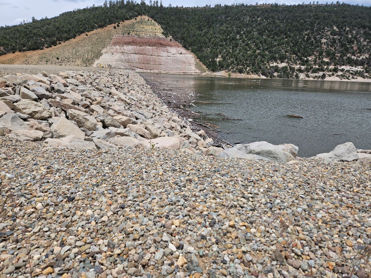
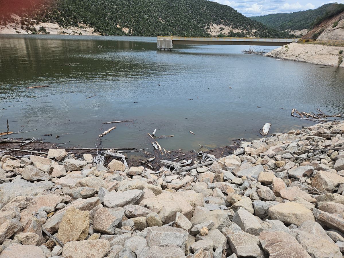
Last Year, the Waterline Was Far, Far Lower
I climbed down the other side of the dam, thinking that a black-armored, DHS tac team would spring from one of the powerhouse and throw a rope net over me for suspected terrorist sabotage. I found the canyon floor again and wandered through thick groves of cottonwood. I crossed back over the Dolores and stumbled on a federal No Trespassing sign. I was in violation of 36 CFR § 2.31.
The Dolores Canyon harbors a multitude of worlds. From Highway 491 which leads through the rolling fields of bean and alfalfa, the land around it seems more like the pitch of the Great Plains of Nebraska. Yet once in a while, even from the highway, you can glimpse the deceptive slice of its defile, rending the land east and west in two great pieces.
Dolores Canyon from Rim
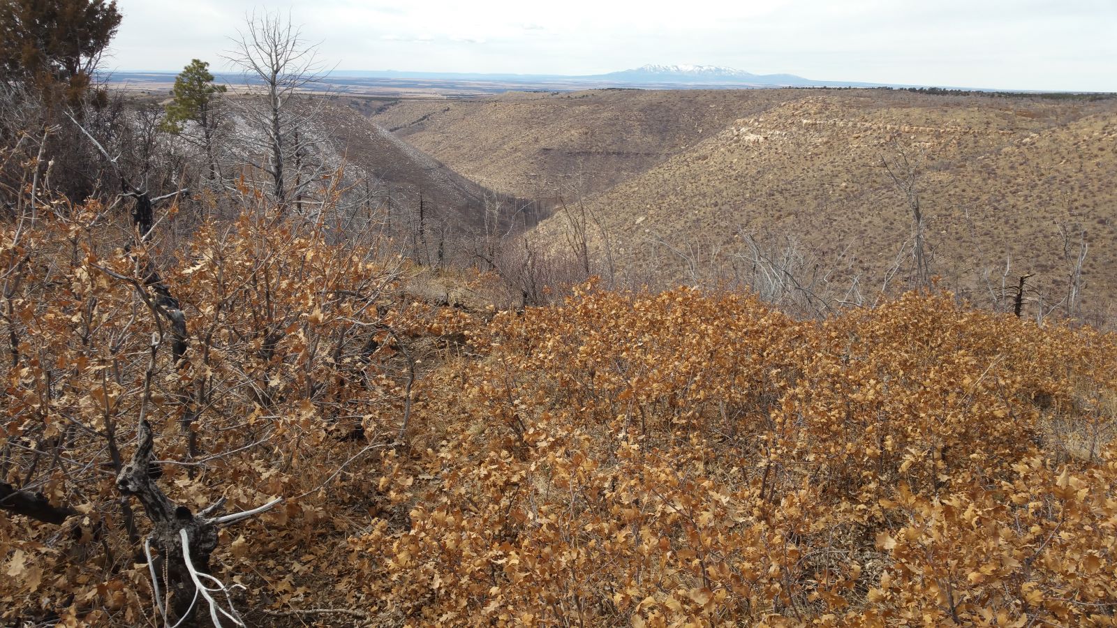
In my lonelier times, usually on Saturday afternoons, I’ll drive out here. If I stay with the rim road, the endless forests meld with the mountains eventually. I’ll find myself in the Glade or at Groundhog Reservoir. From the rim, I have 360’s into four states, and I can spy the Rockies and the laccolithic ranges of the Abajo (visible in the picture above) and the La Sals in Utah, Sleeping Ute on the Ute Mountain Ute Nation, and gather remote peeks at the peaks in northeast AZ and the monoliths on the high deserts outside Shiprock, NM, which are on Navajoland. Squalls dripping with mammatus clouds can roll in from any direction.
Yet here on the canyon bottom today, I see none of that. I see sheer walls the color of a lion. The galleries of Fremont cottonwoods and Gambel oak stretch wide from the banks of the Dolores, a frothing river that sometimes hugs the soaring walls, and sometimes meanders away from the walls to drive a straight course down the middle of the wide, flat floor. Water species like willow and salt cedar, Russian olive and knapweed thrive here. It’s all growing crazy this year because of the heavy snows. One season bears the fruit of the last.
Across the river as it snakes along the rock walls, ponderosa tower, grown from planter-like crevices on the cliffs. I’m amazed at how pines of great height perch precariously over the thin shelves of cliffs.
This brief break from the drought relieves me. Maybe it only lasts a few weeks, since El Nino patterns have returned to the Eastern Pacific, predicting a hot, dry summer. But maybe the drought is over. The models foresaw a warm, dry winter, and they were wrong. Despite all our tech, none of us can predict the future. We make pretty poor prognosticators.
Enjoy this spring, this summer, this day, this moment. The good times didn’t last for the Anasazi. Who’s to say they’ll last for us.
© 2023 by Michael C. Just